Terrain Data
Exercise
What this exercise covers
Downloading vector and raster data:
- Vector: administrative boundary data for the state of Washington from Global Administrative Areas
- Raster: GTOPO30 elevation data from the USGS.
Objectives
Download and inspect spatial data from different sources.
Procedures
Download adminstrative boundary data
For this exercise, we will be subsetting a shapefile of the US states.
The dataset can be found on the Global Administrative Areas website
Select United States from the Country dropdown and set Shapefile as the file format.
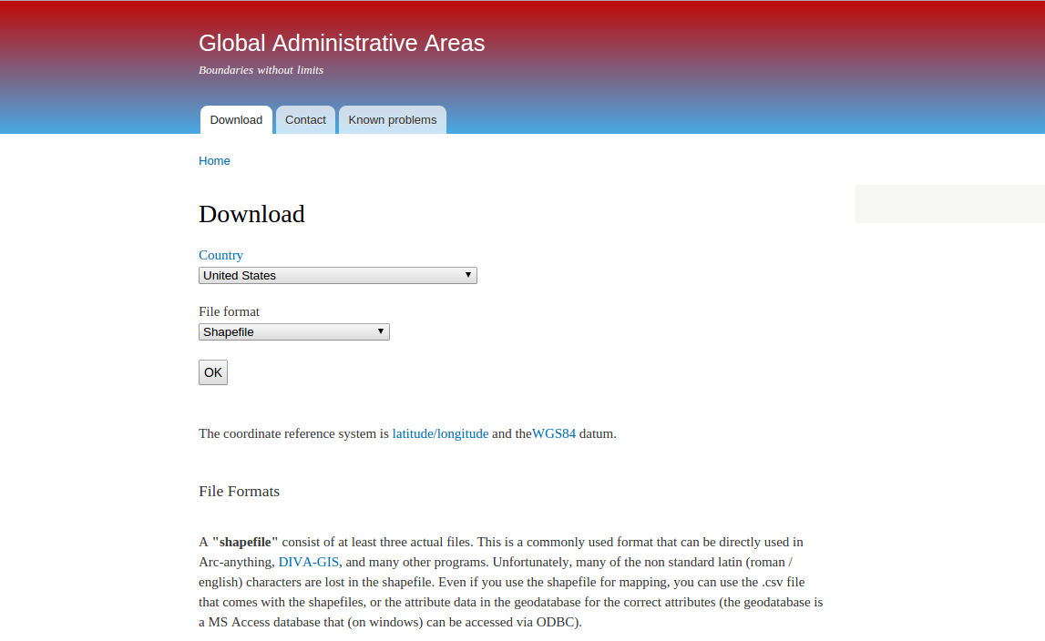
Click ‘OK’ to enter the download screen.
On the next screen, click the blue ‘download’ link to start the download.
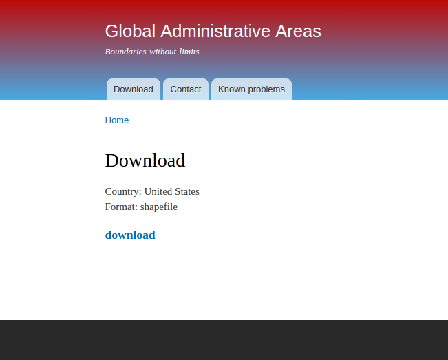
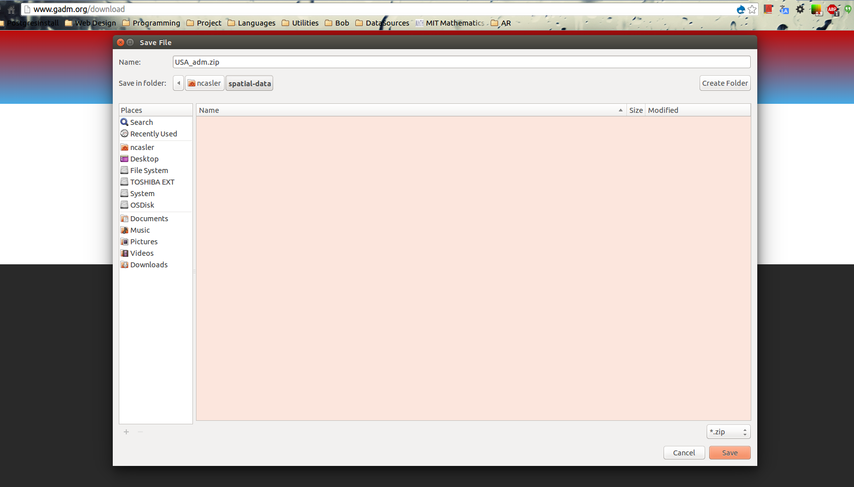
Select a workspace to save the USA_adm.zip dataset
Unpack the zip archive using your choice of file archival software.
(Note: if you don’t have any software to unzip archives, 7-zip is an easy to use free application)
Once the archive has been unpacked, you can see the datasets which should include a pdf, a few .csv files and some .shp,.shx,.dbf and .prj files.
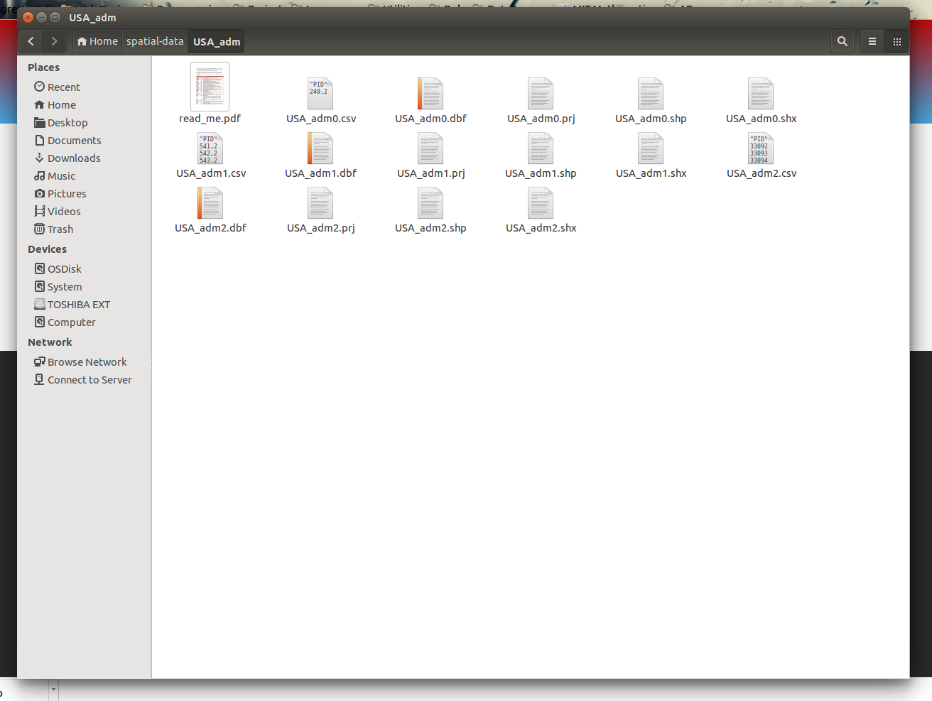
The .shp, .shx, .dbf .prj files make up what we call Shapefiles
In order to visualize the data, we will need to open up QGIS.
Download GTOPO30 elevation data
The DEM can be downloaded from ftp://edcftp.cr.usgs.gov/data/gtopo30/global/w140n90.tar.gz
This tarball can be extracted using an archive extraction application like 7-zip.
(Note: if you are using 7-zip or winRAR to extract the file, you will have to extract the .gz first. Then extract the .tar file from within the extracted subdirectory.)
If you are using Mac or Linux you can extract the files in the terminal with the following command:
tar -zxvf w140m90.tar.gzWhat was covered
- Downloading vector and raster data
- Unpacking files
- Spatial data file types